 As fate would have it, Laura and I were both in the Pacific Northwest for another weekend of hiking before the snow starts accumulating on the higher peaks. On Friday, we met up with three friends in the Goat Rocks Wilderness of the Southern Washington Cascades (roughly in between Mts Rainier and Adams). The goal was to reach the summit of Gilbert Peak (aka Mt Curtis Gilbert), the highest point of the wilderness area at 8,184 feet.
Short version
We met up with our group Friday night intending to hike up to the peak on Saturday to take advantage of the good weather before the rain moved in. We all made it within an hour or two of the top when Laura’s knee that she had twisted on the way up was causing her too much pain to continue. Laura and I returned to camp (getting lost for a few minutes along the way), while the others continued to the top. We hiked out on Sunday in the rain, having seen some beautiful scenery and having shared some great company.
Long version
The Goat Rocks area -- so named because of the bands of mountain goats which live there -- is the eroded remnants of an ancient volcano that erupted well over a million years ago. Though none of my pictures are of a wide enough angle to show the entire crater area, the view is reminiscent of the blown-out mountainside of Mt St Helens -- only much larger and after significant regrowth. The rough outline of the mountain that dominated the landscape some two million years ago can still be seen in the semi-circular ring of peaks around the crater area.
Laura and I made the 3+ hour drive from Seattle after we both got home from work on Friday. We hiked about a mile and a half with only the light of our headlamps under the starry, moonless night sky. Our companions had left us a trail of clues to help us find their campsite. We joined them shortly after nine o'clock and after a bit of unwinding by the campfire, we crawled into the sleeping bags.
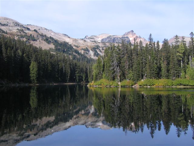
We awoke before sunrise on Saturday and hiked about five miles to Surprise Lake, where we set up camp and loaded our packs with only enough food, water, and clothing to get us to the top of Gilbert Peak. We allowed up to seven hours to navigate the roughly 7-mile roundtrip mostly off-trail hike, which would put us back in our Surprise Lake camp before dark.
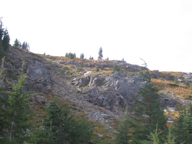 The trail up started under the cover of the forest, but we soon climbed above treeline and saw the terrain rise sharply up to what was the crater rim of the ancient volcano. The trail became a combination of cross-country travel, goat trails, and unmaintained trails. We picked our way up the steep, rocky terrain until we reached the ridge above. On the way, we were fortunate to see a couple of the creatures for which the area was named.
 Atop the ridge, the view was incredible! Mt Adams was so close that we could see the huge crevasses in the glaciers on the north side of the mountain. The hiking became much easier, as we simply had to follow the ridge for awhile. There were a few fun sections of class three scrambling where we had to use our hands and feet to cross. The view on both sides of the ridge was simply spectacular on this sunny day!
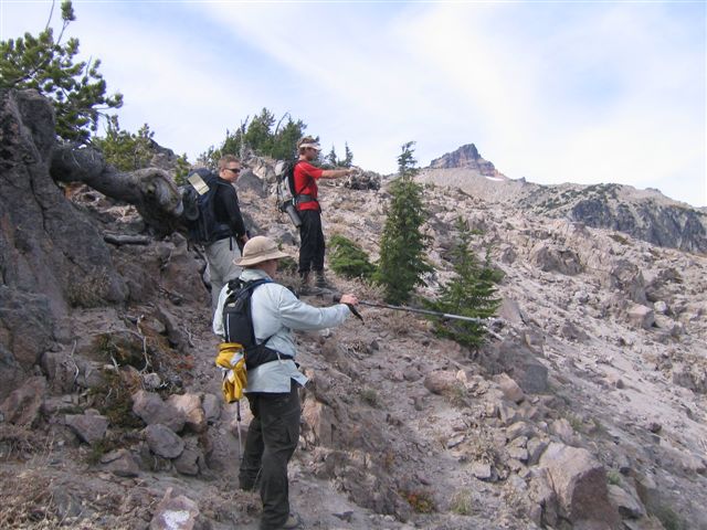 Earlier on the steep terrain, Laura had twisted her knee. She pressed on for awhile, but after crossing most of the ridge, she determined that it was not wise to push through the pain any longer. She and I turned around for camp as the other three continued to the top.
On our way back, we took a slightly different route that involved slightly gentler slopes. It proved to be a good test for our navigation and route-finding skills! I won't say we were exactly lost. (Well, okay, for a short time we were lost.) Shortly after leaving camp that morning, I marked a GPS waypoint and labeled it "Camp." I should have labeled it "Trail shortly outside of camp," because by the time we were returning, I had forgotten that the point was outside of camp and not camp itself. This simple oversight led to a few errors in judgment that caused me to take Laura off-trail through some thick forest. She took several unnecessary and painful steps as we tried to get back on track. Lesson learned, though: Don't trust a GPS waypoint alone over common sense, a map and compass.
By the time we returned to camp, the others had just arrived minutes earlier -- having successfully reached the summit. We cooked some dinner, shared some stories, and crawled into the sleeping bags again.
It rained off and on through the night, and a cold wind blew the following morning. Laura's knee was feeling better after some rest, and the hike out was mostly uneventful. (Except for seeing several huge tracks in the trail that we swear were made by a Sasquatch!) ;-)