The snow conditions, weather, and scenery were spectacular!


I opted not to climb to the true summit -- the top of the "Haystack" -- largely due to the fact that I was hiking alone. I've heard the scramble to the top described anywhere from class 2 to class 4 climbing, which is certainly within my realm of comfort. However... alone, with the route potentially icy or wet and slippery, I felt better leaving that for another time.
The view from the top of the trail was remarkable in that the west face of the mountain drops off seemingly vertically for several thousand feet. It is almost as if you can step to the edge of the cliff and see the streets of North Bend directly below you as if looking at a map from above. The skyline of Seattle was visible some thirty miles away on the edge of Puget Sound. After several minutes soaking in the view, the cold wind prompted me to start my descent.

.jpg)
 As fate would have it, Laura and I were both in the Pacific Northwest for another weekend of hiking before the snow starts accumulating on the higher peaks. On Friday, we met up with three friends in the Goat Rocks Wilderness of the Southern Washington Cascades (roughly in between Mts Rainier and Adams). The goal was to reach the summit of Gilbert Peak (aka Mt Curtis Gilbert), the highest point of the wilderness area at 8,184 feet.
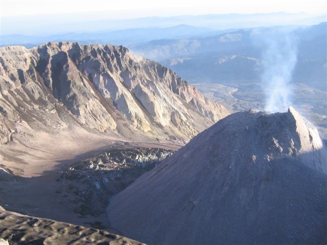
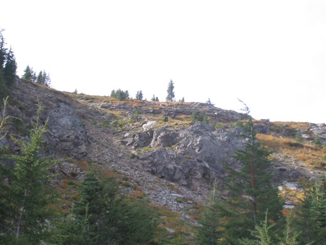 The trail up started under the cover of the forest, but we soon climbed above treeline and saw the terrain rise sharply up to what was the crater rim of the ancient volcano. The trail became a combination of cross-country travel, goat trails, and unmaintained trails. We picked our way up the steep, rocky terrain until we reached the ridge above. On the way, we were fortunate to see a couple of the creatures for which the area was named.
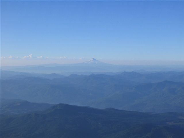
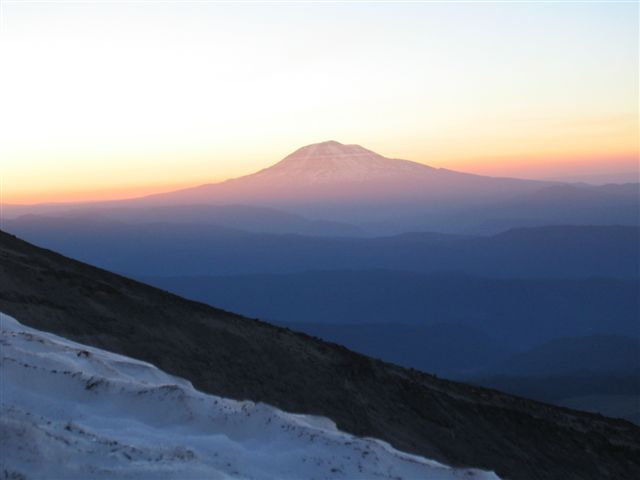
 Atop the ridge, the view was incredible! Mt Adams was so close that we could see the huge crevasses in the glaciers on the north side of the mountain. The hiking became much easier, as we simply had to follow the ridge for awhile. There were a few fun sections of class three scrambling where we had to use our hands and feet to cross. The view on both sides of the ridge was simply spectacular on this sunny day!
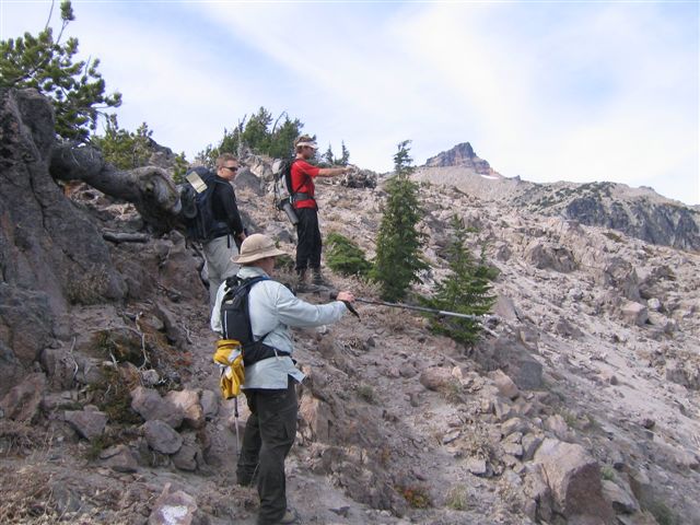 Earlier on the steep terrain, Laura had twisted her knee. She pressed on for awhile, but after crossing most of the ridge, she determined that it was not wise to push through the pain any longer. She and I turned around for camp as the other three continued to the top.
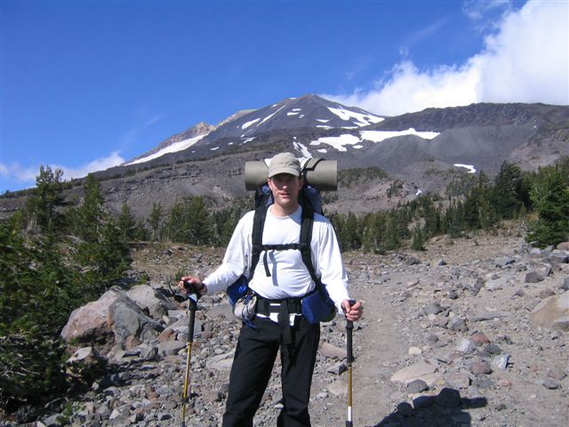
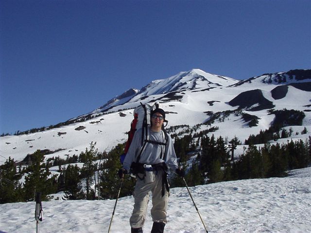
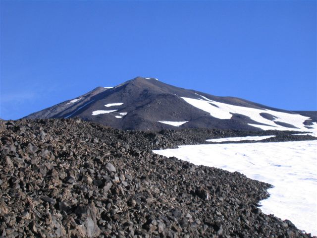
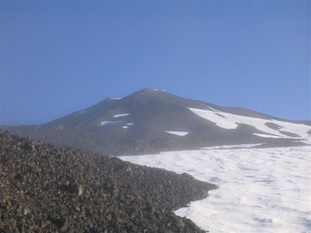
My first climb was in mid-June of 2003, and we had abundant snow from about 7,000 feet up. The first thing I noticed when I got my first full view of the mountain on this trip was how bare and rocky the mountain appeared this late in the season. She almost appeared naked.
The weather forecast for the weekend was a little iffy. We were likely to see lots of clouds with some rain/sleet/snow around the mountain, but there was potential for some clear periods as well. For all of the above, the forecast was pretty much right on.
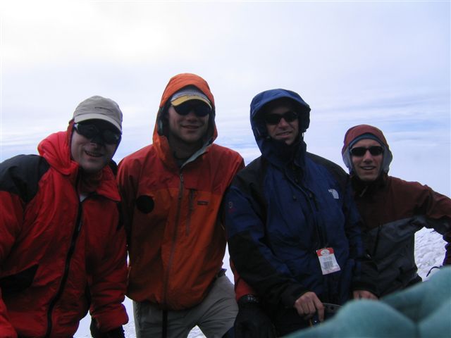
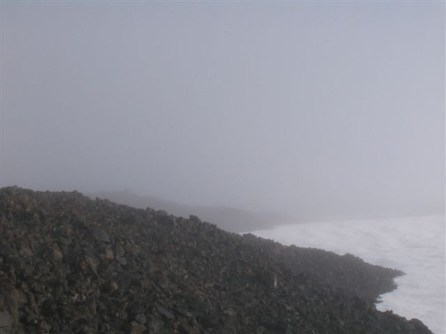
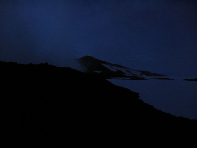
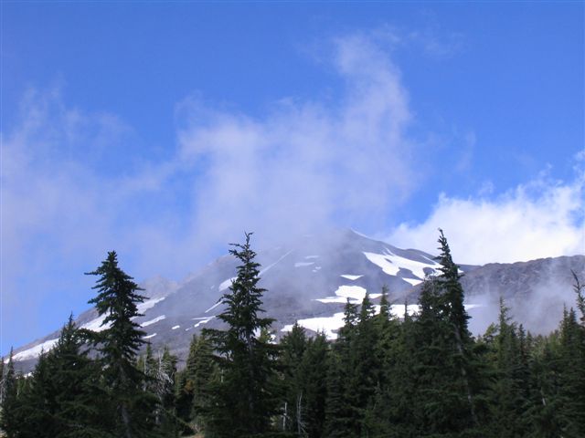
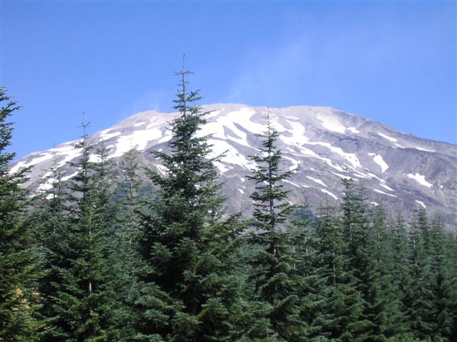
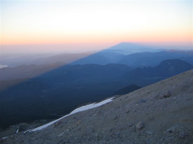
Our group of four started hiking up on Saturday around 2:00 PM from the Cold Springs Campground at 5,600 ft. When the wind started blowing and the falling snow was sticking to our clothing and packs in near white-out conditions, we opted to set up camp and get an early start the next morning. Of course, within an hour of setting up camp, the skies cleared and we cooked dinner in the warmth of the sun. Then we ate dinner under cloudy skies. We woke up in our camp at 8,600 feet at 2:00 AM to mostly clear skies, intending to start for the top, but saw heavy clouds rolling in and opted to wait. After the sun rose, there were intermittent periods of clear skies and thick clouds. I took three pictures in the direction of the summit within a half-hour that illustrate how quickly things were changing.
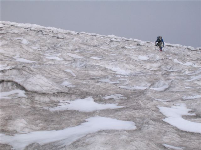
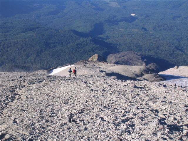
We started climbing up in fair conditions around 9:00 AM, but turned around at 10,600 feet at noon as clouds piled up around us... realizing we would not reach the top before our designated turn-around time of 1:00. We navigated back to our camp in mostly white-out conditions, stopping briefly to help a disoriented climber find his way back to his camp. It was good practice navigating in white-out conditions! After packing up camp, we hiked back to the trailhead. It was clear below, but the top of the mountain remained shrouded behind the clouds.